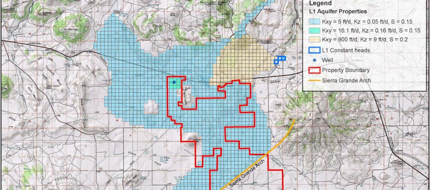
Groundwater Modeling
GGI constructs site-specific models to simulate various hydrogeologic conditions. These models are used to plan for future water availability, evaluate pumping effects on nearby wells in a water right transfer, assess the potential for contaminated groundwater transport to water supply wells, and well field management.
Modeling Services:
Groundwater / Surface Water Interaction
Fracture Flow Aquifers
Well Field Management
Water Rights Transfer & Pumping Effects
Water Availability & Sustainability Planning
Groundwater Contamination Transport
Selected Projects:
Moapa Valley Water District 2014 Integrated Water Resources Plan (NV)
Nye County’s Water Supply Appraisal Investigation Report (NV)
El Dorado’s Water Conservation and Water Resources Plan (NM)
Village of Wagon Mound Preliminary Engineering Report for Water Resources (NM)
Town of Red River Water Conservation Plan and Water Asset Management Plan (NM)
Town of Hagerman Water Conservation Plan (NM)
GGI has conducted regional and sub-regional studies to determine water resource availability, regional water level variations through time, horizontal and vertical variations in water quality and aquifer productivity, and recharge rates throughout New Mexico and the southwest. These studies have included:
Regional subsurface stratigraphic correlations for basin analysis (publication)
Isotopic studies to constrain sources, timing and rate of recharge (publication)
Geochemical ‘fingerprinting’ of aquifers using major element and isotope geochemistry
Stream gaging to identify ‘losing’ stream reaches that recharge the aquifer and ‘gaining’ stream reaches that are aquifer discharge points
Well and spring inventories for tribal governments
Evaluation of effects of groundwater development on hydrologically sensitive springs, streams, and other water sources

“Water resources for a sustainable future.”